Quick answer: Precision agriculture software combines location data, sensors, machinery, imagery and analytics to help farms manage variability within fields and herds. It turns raw observations into actions such as where to scout, irrigate, apply inputs, service equipment or investigate crop risk.
A successful platform is more than a dashboard. It needs reliable data pipelines, geospatial context, offline field workflows, practical alerts and integrations with the systems people already use. DreamzTech provides agriculture software development services for organizations building these connected farming capabilities.
What is precision agriculture software?
Precision agriculture software is a category of farm technology that uses spatial, sensor and operational data to manage agricultural activity at a more specific level than an entire farm. The unit of analysis may be a field zone, plant, animal, irrigation block, machine or production batch.
Examples include variable-rate application maps, yield and soil layers, satellite or drone scouting, sensor-based irrigation, livestock monitoring, machine telematics and predictive crop-risk alerts.
Adoption is growing, but it is not uniform. USDA Economic Research Service data show that precision-technology use varies by farm size and technology. In 2023, guidance autosteering was used by 52% of midsize and 70% of large-scale crop-producing farms, while yield, soil and related mapping tools were used on 68% of large-scale crop farms. This is one reason products need flexible onboarding and business models rather than a one-size-fits-all design.
How the precision agriculture technology stack works
1. Data collection
Data may come from soil-moisture and weather sensors, machinery, GPS-enabled mobile devices, livestock tags, laboratory results, satellites, drones, irrigation systems and manual field observations. Each source has different frequency, accuracy, format and connectivity constraints.
2. Ingestion and normalization
APIs, gateways and file imports bring data into the platform. A normalization layer converts inconsistent units, timestamps, coordinates, device identifiers and field names into a stable model. Validation rules flag missing, duplicated or implausible readings before they affect decisions.
3. Geospatial context
GIS connects observations to farms, fields, management zones and assets. The platform may store boundaries, elevation, soil properties, imagery, application maps, sampling points and historical yield layers. Spatial indexing is essential for responsive maps and location-based queries.
4. Analytics and decision support
Rules and models detect thresholds, trends, anomalies or predicted outcomes. The result should be expressed as a practical recommendation with context: what happened, where, how confident the system is, what evidence supports it and what a user can do next.
5. Workflow and execution
Insights have limited value if they remain in a dashboard. Useful systems create scouting tasks, irrigation actions, work orders, notifications, prescriptions or approval requests and then record the outcome.
AI use cases in precision farming
- Crop-disease risk: combine weather, imagery and field observations to prioritize scouting.
- Computer vision: classify plant stress, weeds, fruit quality or visible livestock conditions from images.
- Yield forecasting: use historical production, weather, soil and management data to estimate outcomes.
- Anomaly detection: identify unusual sensor, irrigation, environmental or machine behavior.
- Recommendations: rank actions based on agronomic rules, business constraints and model output.
- Natural-language assistance: let authorized users query records, summarize field activity or draft reports while preserving source citations.
AI should support accountable decisions rather than hide them. Production systems need validation data, performance monitoring, human review for consequential recommendations and clear handling for conditions outside the model’s training data.
IoT requirements for agricultural environments
Field devices operate under conditions that conventional office software does not face: intermittent connectivity, weather exposure, limited power, long replacement cycles and different vendor protocols. The application architecture should account for buffering, retries, device identity, secure updates, time synchronization and graceful operation when a connection is unavailable.
NIST advises that IoT cybersecurity requirements should be considered throughout product development and lifecycle support. Its NISTIR 8259 guidance highlights capabilities such as device identification, data protection, secure configuration and software updates. These principles are relevant when agricultural platforms connect operational devices to cloud services.
For a broader list of field-sensor and automation examples, read IoT Applications in Agriculture.
Common precision agriculture modules
| Module | Typical capabilities |
|---|---|
| Field GIS | Boundaries, zones, layers, samples, prescriptions and map-based history |
| Scouting | Offline forms, GPS observations, photos, severity ratings and assignments |
| Remote sensing | Satellite or drone imagery, vegetation indexes, change detection and review |
| Irrigation | Moisture readings, weather context, schedules, valves, alerts and water-use records |
| Machinery | Telematics, task data, utilization, maintenance and mixed-fleet integration |
| Livestock | Identity, location, activity, health events, feeding and production records |
| Analytics | Yield, input efficiency, risk scoring, forecasting and comparative reporting |
Smart irrigation as a software workflow
Soil-moisture data is useful only when it is converted into a reliable workflow. A platform may combine sensor readings, weather conditions, crop stage, field characteristics, system capacity and water rules to recommend or automate irrigation.
The U.S. EPA explains that soil-moisture-based irrigation controllers can bypass scheduled watering when plants do not need it. Agricultural implementations are more complex than residential systems, but the design principle is similar: use measured conditions to avoid unnecessary operation while protecting plant needs.
Build-versus-buy decision
Buying an established product is usually appropriate when standard functionality covers the operation and the required equipment, data and accounting integrations already exist. Custom development is more relevant when the organization is creating a new agritech product, combining multiple vendors, supporting proprietary workflows or turning a unique data asset into a service.
A hybrid approach is common: retain proven GIS, weather, device or imagery services while developing the workflow, analytics, mobile experience and integration layer that differentiate the product.
Implementation roadmap
- Define the decision: identify the exact operational decision or workflow the product will improve.
- Audit the data: verify ownership, access, quality, resolution, history and update frequency.
- Design for field conditions: plan offline behavior, device limitations, mapping and role-based usability.
- Build a thin end-to-end pilot: connect one data source to one useful action for one user group.
- Validate in season: test under real agronomic, connectivity and workload conditions.
- Measure outcomes: track adoption, alert quality, response time, input use, downtime or another agreed metric.
- Scale deliberately: add crops, regions, devices and models only after the operating model works.
A real-world precision farming example
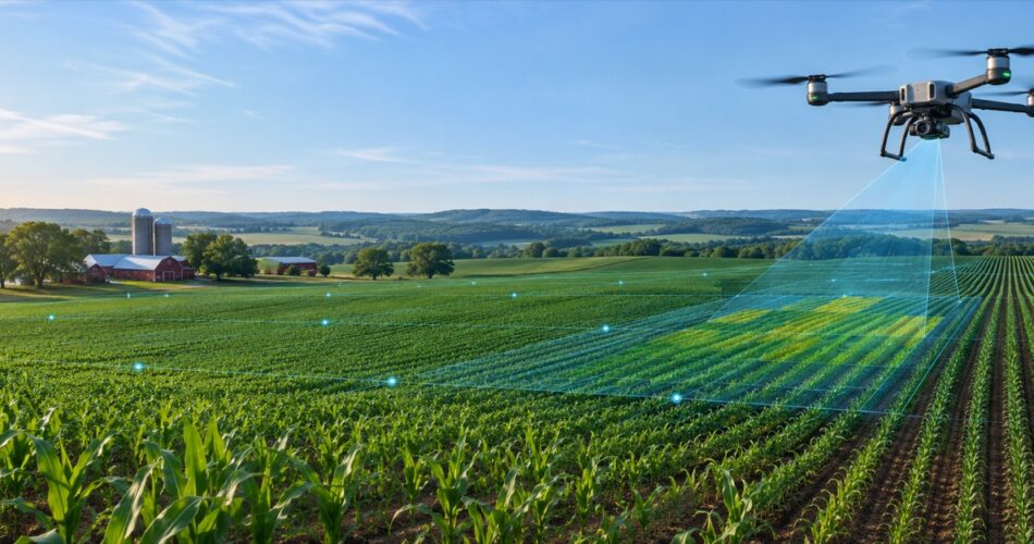
DreamzTech built an AI, IoT and drone-powered precision farming platform that brought field data, predictive analytics and crop-risk detection into a shared system for farmers and government stakeholders. The case study shows how mobile workflows, connected data and analytics can be combined around operational outcomes.
Frequently asked questions
What is the difference between farm management and precision agriculture software?
Farm management software coordinates the broader business and operational record. Precision agriculture software focuses more deeply on variability, location, sensing and targeted decisions. A mature platform may include both.
Does precision agriculture software require IoT devices?
No. It can begin with field records, GIS, machine files, weather data or satellite imagery. IoT devices add timely observations but also introduce connectivity, maintenance and security requirements.
Can precision agriculture software work with mixed equipment brands?
Yes, when the architecture supports multiple APIs and file formats and uses a normalized internal data model. Integration availability and data rights should be confirmed during discovery.
How should AI recommendations be validated?
Define the target outcome, compare recommendations with representative historical and field data, measure error and false-alert rates, involve domain experts, and monitor performance after deployment.
What is the best first precision-agriculture use case?
Choose a decision with measurable value, accessible data and a clear user action. Scouting prioritization, irrigation alerts or equipment monitoring can be easier to validate than a broad autonomous platform.
Build a practical precision agriculture roadmap
The strongest products connect technology to a specific field decision and operating process. DreamzTech can help define the architecture, mobile experience, GIS, IoT integrations, analytics and rollout plan for a new or existing precision-agriculture platform.